Altitude-Azimuth
Equatorial System
Ecliptic Guides
Galactic Guides
There are two types of coordinates used by amateur
astronomers: altitude-azimuth (alt-az) and
equatorial. Professional astronomers use equatorial,
ecliptic and sometimes galactic guides.
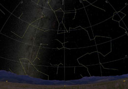
Altitude-Azimuth:
Altitude-Azimuth is the simplest to define: this
system is based on the observer. Altitude is up and
down while azimuth is across the horizon. Zero and 180º
is your horizon, and 90º
is straight above - called Zenith. This system is difficult to use
in Astronomy for two reasons: the celestial sphere
does not rotate this way, and the coordinates of
stars,
planets, and
galaxies are given based on the
equatorial system.
If you were to give coordinates based on your
location of an object you see in the sky, an
observer in another country (or even another state)
would not know which object to which you are
referring. Back to Top
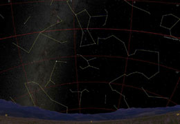
| Image Credit: Starry Night v. 4.5 Equatorial System:
The equatorial system is based on
Earth's rotation
(the sky does not really rotate, the
Earth does).
The axis of rotation for the equatorial system is
the North and South Poles. Measurements are made by
Right-Ascension (left and right - longitude) and Declination (up
and down - latitude). The celestial equator is the imaginary
plane that marks 0º
declination. Right-Ascension is measured in hours,
minutes, and seconds with its 0 point (0h 0m 0s) to
be the imaginary line connecting the North and South
Celestial Poles crossing the Celestial Equator.
The coordinates of celestial objects given in the
equatorial system are universal. Computerized
telescopes and star charts use this method to plot
and track objects in the
night sky. This system is
also very convenient when trying to find an object
during the daylight hours. The point in which the
ecliptic plane meets the celestial equator is called
the Vernal Equinox. The equatorial coordinate
system is also known as the Celestial Coordinate
System. Other terms to remember are NCP (North
Celestial Pole) and SCP (South Celestial Pole). Back
to Top | Image Credit: Starry Night v. 4.5
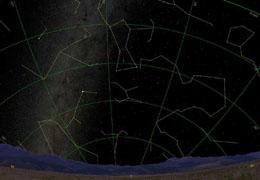
Ecliptic Guides:
This coordinate system is
based on the
Sun. The North and South Poles are the
points above and below the
Sun, and the Equator is
the extended plane of the
Sun's equator. Zero
meridian is the Vernal Equinox. The ecliptic plane
is the orbit of
Earth about the
Sun.
This coordinate system is useful when plotting
the positions of the other
planets as well as
asteroids and
comets.
Back to Top | Image Credit:
Starry Night v. 4.5
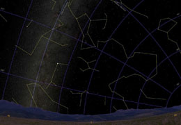
Galactic Guides:
The
galactic coordinate system is based on the ecliptic,
except the North and South Poles are the points
above and below the center of our
galaxy, the
Milky
Way. This is the axis of rotation. The equatorial
plane corresponds to the disk plane of
our galaxy.
Zero meridian is the point in which the imaginary
line connecting the galactic north and south poles
crosses the galactic equator.
This system is rarely used by amateurs and
professionals. Only Astronomers studying galactic
dynamics and rotation will find this coordinate
system useful.
Back to Top | Image Credit:
Starry Night v. 4.5 |